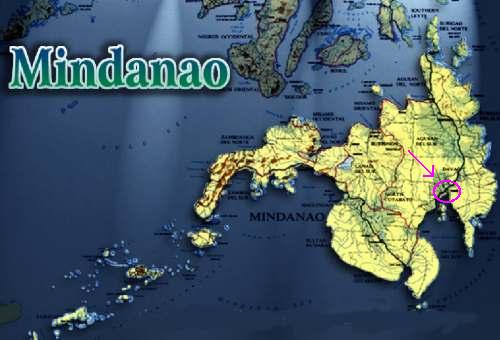


GEOGRAPHICAL LOCATION:
The City of Tagum is the capital town of Davao del Norte Province located north of Davao City, the regional capital of Region XI. The city lies between 7ş 26' North latitude and 124ş 48' East longitude. It is about 56 kilometers from the city proper and approximately 110 kilometers west of Mati, the capital town of Davao Oriental.
The strategic geographical location of Tagum is conducive to its becoming the center of commerce and trade. It is intersected by two national highways connecting itselft to the different provinces, cities and municipalities of Mindanao in all directions, north, south, east and west.
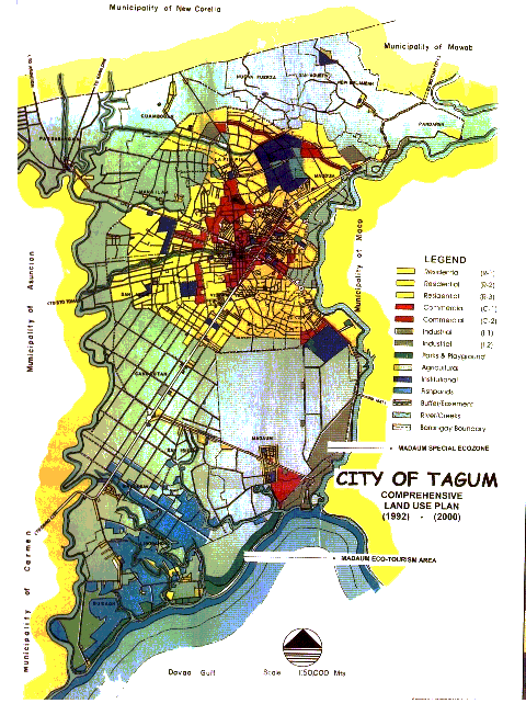
TOPOGRAPHY:
Tagum is generally flat with certain rolling portions in the northern side and coastal roads in the Southern portion. Two (2) major water lines bound the eastern and western side: Hijo River on the east and Liboganon-Tagum River on the west.